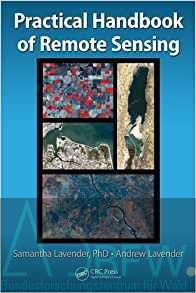
Our first book is out now!!! A dull and damp Saturday afternoon was spectacularly brightened by a deliveryman’s knock at the door, who handed over our first copies of the Practical Handbook of Remote Sensing – as you can see in the picture. It was the first time we’d got the finished paperback in our hands. Very exciting! The book was written by us, Samantha Lavender and Andrew Lavender, and is published by CRC Press of the Taylor & Francis Group. It is a general how-to guide for anyone wanting to use remote sensing, guiding inexperienced individuals through the principles and science of remote sensing, and giving them the skills to undertake practical remote sensing at home with just a computer and free-to-access desktop software. It’s a book Sam has wanted to write for many years: something which we hope opens up the exciting field we work in to new people. However she quickly realized that if she was writing an ‘idiots guide’, she needed an idiot – which she says is where I came in! Personally, I prefer the publisher description of me as a non-expert navigating the subject for the first time. The first half of the book begins with the basic principles and history of remote sensing, next we have the science behind remote sensing and image processing and finally the first half is finished off with chapters on practical remote sensing and image processing with a variety of example exercises. The second half is focused on applications of remote sensing within both land and marine environments, with details on the applications, scientific theory of the remote sensing techniques and associated practical exercises. We aimed to make the book practical, readable and easy to understand. The principle we used was that if I couldn’t understand a section of the book, it had to be rewritten until I could understand it! We have also based it on open source software, using ESA’s Sentinel Application Platform (SNAP) and QGIS as our remote sensing and geographical information systems software. The default dataset we’ve used is Landsat; again as it is freely accessible, although a number of other datasets are also included. We’d also like to start to build a community of ‘new’ remote sensors and so we launched a complementary website last weekend, www.playingwithrsdata.com – designed and written by the excellent i-Create Design and Square Apple. The website will keep the book users updated on any changes to software or data used in the book, provide additional exercises and a forum for people to ask questions and continue their learning. We’re both very excited and proud about having our first book published, and we hope that people will enjoy reading it and working through the exercises to gain new skills. What’s that? You want to know where you can immediately get hold of a copy of the Practical Handbook of Remote Sensing. Well, clicking on this link will take you to our wonderful publishers who can make that happen! Was ist Fernerkundung? Definition von Fernerkundung; Geschichte der Fernerkundung; Grundsätze der Fernerkundung; Nützlichkeit der Fernerkundung; Herausforderungen der Fernerkundung; Zusammenfassung und Umfang des Buches; Schlüsselbegriffe; Referenzen; Wie funktioniert Fernerkundung? Grundsätze der Satellitenfernbedienung; Was der Sensor in der Fernerkundung misst; EM-Spektrum; Wie nehmen Sensoren Messungen? Räumliche, spektrale und zeitliche Auflösungen; Zusammenfassung; Schlüsselbegriffe; Referenzen; Daten verfügbar von Fernerkundung; Optische Daten; Mikrowellen-Daten; Unterscheidung zwischen frei verfügbaren Daten und Handelsdaten; Wo finden Sie Daten; Auswahl der richtigen Art von Daten für eine bestimmte Anwendung; Grundlegende Fernerkundung mit Landsat-Daten; Notation für praktische Übungen im Buch; Geschichte von Landsat; Zusammenfassung der Landsat-Missionen; Verschiedene Datenmengen verfügbar; Zugriff auf die Level 1 Landsat Data; Auswählen der Stufe 1; Landsat-Daten zum Download; Weltweites Referenzsystem; Herunterladen der Level 1 Landsat Daten; Grundlegende Betrachtung und Verwendung der Landsat-Daten; Landsat-Kalibrierung und Anomalien; Praktische Übung: Suchen, Herunterladen und Anzeigen von Landsat-Daten; Einführung in die Bildverarbeitung; Was ist ein Bild und wie werden sie erworben ?; Bild-Eigenschaften; Warum sind ferngesteuerte Bilder oft groß in Größe? Bildverarbeitung Technik: Kontrast Manipulation / Histogramm Stretching; Bildverarbeitungstechnik: Filterpixel; Bildverarbeitungstechnik: Anwendung von Algorithmen und Farbpaletten; Praktische Bildverarbeitung; Bildverarbeitungssoftware; Installieren des SNAP; Einführung in die SNAP; Die Geometrie von Landsat Level 1 Data; Landsat Level 1 Geo TIFF Dateien; Herunterladen der Level 1 GeoTIFF Daten; Importieren von Landsat Level 1 Daten in SNAP; Praktische Bildverarbeitung: Erstellen einfacher Farbverbundwerkstoffe; Praktische Bildverarbeitung: Erstellen einer Teilmenge; Praktische Bildverarbeitung: Kontrastverstärkung durch Histogramm Stretching; Praktische Bildverarbeitung: Farbpaletten; Praktische Bildverarbeitung: Anwendung eines Filters; Praktische Bildverarbeitung: Anwendung des NDVI-Algorithmus; Geographisches Informationssystem und eine Einführung in QGIS; Einführung in GIS; GIS Softwarepakete; QGIS installieren; Einführung in QGIS; Importieren von Fernerkundungsdaten in QGIS; GIS Datenhandling Technik: Kontrastverstärkung / Histogramm Stretch; GIS Datenhandhabungstechnik: Kombinieren von Bildern; GIS Datenhandhabungstechniken: Hinzufügen kartographischer Schichten; CRS-Anpassungen innerhalb von QGIS; Speichern von Bildern und Projekten in QGIS; Städtische Umgebungen und ihre Unterschriften; Einführung in die Anwendungskapitel des Buches; Städtische Umgebungen; Einführung in die optische Signatur von urbanen Oberflächen; Einführung in die thermischen Signaturen von städtischen Oberflächen; Städtische Anwendungen; Praktische Übung: Spektrale und thermische Signaturen; Landschaft Evolution; Grundsätze der Verwendung von Zeitreihenanalyse für die Überwachung; Landschaft Evolution; Landschaft Evolution Techniken; Optische Vegetationsindizes für Landschaftsentwicklung; Mikrowellen-Daten für die Landschaftsentwicklung; Landschaft Evolution Anwendungen; Praktische Übung: Betreute Landbedeckung Klassifizierung; Binnengewässer und Wasserkreislauf; Optische und thermische Daten für Binnengewässer; Mikrowellen-Daten zur Überwachung des Wasserkreislaufs; Binnenwasseranwendungen; Praktische Übung: Analyse der Aswan-Talsperre; Küstengewässer und Küstenlinie Evolution; Optische Daten; Passive Mikrowellen-Signaturen aus dem Ozean; Küstenanwendungen; Praktische Übung-New York Bight; Wohin als nächstes? Entwicklungen in der Satelliten-Hardware; Entwicklungen in der Datenverarbeitung; Entwicklungen in Anwendungen; Langzeitentwicklungen für Fernerkundung; Weiterentwicklung deines Wissens; Beispiele für weiteres Lesen What Is Remote Sensing? Definition of Remote Sensing; History of Remote Sensing; Principles of Remote Sensing; Usefulness of Remote Sensing; Challenges of Remote Sensing; Summary and Scope of the Book; Key Terms; References; How Does Remote Sensing Work? Principles of Satellite Remote Sensing; What the Sensor Measures in Remote Sensing; EM Spectrum; How Do Sensors Take Measurements? Spatial, Spectral, and Temporal Resolutions; Summary; Key Terms; References; Data Available from Remote Sensing; Optical Data; Microwave Data; Distinction between Freely Available Data and Commercial Data; Where to Find Data; Picking the Right Type of Data for a Particular Application; Basic Remote Sensing Using Landsat Data; Notation Used for Practical Exercises within the Book; History of Landsat; Summary of the Landsat Missions; Different Levels of Data Available; Accessing the Level 1 Landsat Data; Selecting the Level 1 ; Landsat Data to Download; Worldwide Reference System; Downloading the Level 1 Landsat Data; Basic Viewing and Using the Landsat Data; Landsat Calibration and Anomalies; Practical Exercise: Finding, Downloading, and Viewing Landsat Data; Introduction to Image Processing; What Is an Image and How Are They Acquired?; Image Properties; Why Are Remotely Sensed Images Often Large in Size? Image Processing Technique: Contrast Manipulation/Histogram Stretching; Image Processing Technique: Filtering Pixels; Image Processing Technique: Applying Algorithms and Color Palettes; Practical Image Processing; Image Processing Software; Installing the SNAP; Introduction to the SNAP; The Geometry of Landsat Level 1 Data; Landsat Level 1 Geo TIFF Files; Downloading the Level 1 GeoTIFF Data; Importing Landsat Level 1 Data into SNAP; Practical Image Processing: Creating Simple Color Composites; Practical Image Processing: Creating a Subset; Practical Image Processing: Contrast Enhancement through Histogram Stretching; Practical Image Processing: Color Palettes; Practical Image Processing: Applying a Filter; Practical Image Processing: Applying the NDVI Algorithm; Geographic Information System and an Introduction to QGIS; Introduction to GIS; GIS Software Packages; Installing QGIS; Introduction to QGIS; Importing Remote Sensing Data into QGIS; GIS Data Handling Technique: Contrast Enhancement/Histogram Stretch; GIS Data Handling Technique: Combining Images; GIS Data Handling Techniques: Adding Cartographic Layers; CRS Adjustments within QGIS; Saving Images and Projects in QGIS; Urban Environments and Their Signatures; Introduction to Application Chapters of the Book; Urban Environments; Introduction to the Optical Signatures of Urban Surfaces; Introduction to the Thermal Signatures of Urban Surfaces; Urban Applications; Practical Exercise: Spectral and Thermal Signatures; Landscape Evolution; Principles of Using Time-Series Analysis for Monitoring; Landscape Evolution; Landscape Evolution Techniques; Optical Vegetation Indices for Landscape Evolution; Microwave Data for Landscape Evolution; Landscape Evolution Applications; Practical Exercise: Supervised Land Cover Classification; Inland Waters and the Water Cycle; Optical and Thermal Data for Inland Waters; Microwave Data for Monitoring the Water Cycle; Inland Water Applications; Practical Exercise: Analysis of the Aswan Dam; Coastal Waters and Coastline Evolution; Optical Data; Passive Microwave Signatures from the Ocean; Coastal Applications; Practical Exercise—New York Bight; Where to Next? Developments in Satellite Hardware; Developments in Data Processing; Developments in Applications; Long-Term Developments for Remote Sensing; Developing Your Knowledge Further; Examples of Further Reading